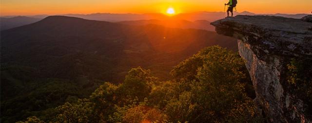
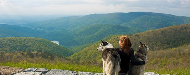
The state of Virginia is blessed with plentiful tracts of wild lands, places where backpackers can find large parcels of terrain laced with trails and places to trek for days, such as Shenandoah National Park and the vast George Washington & Jefferson National Forests. These backpacking destinations feature crashing waterfalls and dramatic overlooks – as well as awesome campsites to pitch your tent.
A Virginia backpacking adventure can lead to destinations high and low, from the Atlantic shores of False Cape State Park to the historic highlands of Cumberland Gap National Park. Virginia’s unforgettable backpacking destinations lead through federally designated wildernesses and scenic areas and along the Appalachian Trail.
Here are ten unforgettable backpacking destinations in Virginia, with the nearest towns and some tips to help you plan an amazing outdoor getaway in Virginia. Elevation highs and lows give you an idea of the terrain, and GPS coordinates deliver you to the trailhead.
Ridge Trail at Cumberland Gap National Historical Park
Nearest Town: Ewing
Backpack Mileage: 20-mile end-to-end
Elevation Highs and Lows: 3,400 feet high point, 1,410 feet low point
GPS Trailhead Coordinates: 36.60967, -83.6379
This end-to-end backpack leads past both natural and historical highlights, with views aplenty, and includes a visit to the Hensley Settlement, a collection of preserved cabins and farm buildings of a forgotten mountaintop community.
Cumberland Gap National Historical Park is an excellent backpacking destination, so even if you cannot arrange two cars for a shuttle, consider making a one-night loop or a two or three-night trip, then backtrack.
The entirety of the Ridge Trail straddles the Virginia- Kentucky border. The Lewis Hollow Trail leads from the Virginia side up to the Ridge Trail. Along the way, pass Skylight Cave, Indian Rock shelter, numerous preserved buildings of the Hensley Settlement, and Sand Cave with its waterfall. Top it off with a panorama from atop White Rock, where you can see the Smoky Mountains on a clear day. The Ewing Trail leads back to the lowlands.
The Camping: Five designated campsites – including one with a primitive cabin – are stretched out along the Ridge Trail. However, a backcountry permit -- obtained at the park visitor center -- is required.
Essential Fact: Springs are located within a short distance of each designated backcountry campsite. The trailside cabin at Martins Fork can be reserved in advance.
Mount Rogers High Country
Nearest Town: Konnarock
Backpack Mileages: 10-25 miles
Elevation Highs and Lows: 5,728 feet high point, 3,600 feet low point
GPS Trailhead Coordinates: 36.64618, -81.58307

Mount Rogers
Photo Credit: Kyle LaFerriere, @laferriere.photography
Explore Virginia’s highest elevations within Mount Rogers National Recreation Area, where you can hike amid meadows, spruce-fir forests, rock spires, and crashing streams. The pathways change with the landscapes, from narrow track foot trails to wider equestrian paths and from deep woods tracks to rock-strewn treadways open to the sky overhead. Additionally, you can travel through two wildernesses and Grayson Highlands State Park. A wealth of connector paths enables you to alter your backpack as desired.
The Mount Rogers High Country is a must-experience for Virginia backpackers. This elevated land contains a maze of trails amid superlatives including Virginia’s highest point, vistas that extend for miles in all directions, and wildlife, including the famed wild ponies.
The Camping: Trail shelters are located on the Appalachian Trail as it traverses the high country, and there are numerous campsites throughout the park.
Essential Fact: Mount Rogers can have some of the harshest weather in the state. Be prepared for cloudy, windy, foggy, and rainy weather any time of year.
Torry Ridge Backcountry
Nearest Town: Sherando
Backpack Mileages: 20-mile loop
Elevation Highs and Lows: 3,500 feet high point, 1,700 feet low point
GPS Trailhead Coordinates: 37.90908, -79.05874
This loop backpack has tons of scenic payoffs that you earn with climbs and descents. Leave Slacks Overlook on the Blue Ridge Parkway, crossing the Parkway to make White Rock Falls. Beyond the falls, cross the Parkway again, dropping to South Fork Back Creek.
Ahead, Sherando Lake Recreation Area is centered with a pair of lakes and a series of nature trails that you can incorporate into your loop. The recreation area also has water spigots running during the warm season. From Sherando Lake, ascend Torry Ridge, passing view-laden Overlook Rock where Three Ridges Mountain rises in the distance. Work your way through the lowland to Mills Creek, then follow a steep climb up the now-wooded Bald Mountain.
The Camping: Backcountry campsites can be found on South Fork Back Creek, lower Orebank Creek, and lower Mills Creek. Beyond, Sherando Lake Recreation Area offers developed campsites, water, and hot showers in season if you desire.
Essential Fact: This loop requires a little over 4,800 feet of ascending and descending.
Ramseys Draft Wilderness
Nearest Town: Staunton
Backpack Mileages: 16-mile loop
Elevation Highs and Lows: 4,000 feet high point, 2,100 feet low point
GPS Trailhead Coordinates: 38.30838, -79.36089
This loop backpack starts by heading up Ramseys Draft, a mountain trout stream with everywhere-you-look beauty. Backpackers will be forced to cross the stream several times. The difficulty of crossings will reflect the season. In spring, the waters will be higher, decreasing to autumn, when dry-footed rock hops are the norm. Avoid the trail in winter. Remember, all trails here are minimally maintained, keeping with a wilderness atmosphere.
The uppermost part of the Ramseys Draft Trail steepens when it heads up Right Prong, then eases up near Hiner Spring. Your loop heads right on the Tearjacket Trail, then joins the Bald Ridge Trail. Trek among hardwoods on a surprisingly undulating path that is sometimes indistinct in places, but stay along the ridge. Intersect the Bridge Hollow Trail to a steep-sided slope, then back down to the trailhead.
The Camping: Despite the steep valley, campsites are scattered along Ramseys Draft as well as up near Hiner Spring. Campsites on Bald Ridge will be waterless. Carry water if you want to stay overnight there.
Essential Fact: The steep-sided Ramseys Draft valley wasn’t settled, thus has pockets of old growth woods, especially the upper valley.
Northern Massanutten Mountain
Nearest Town: Strasburg
Backpack Mileages: 20+ miles of trails
Elevation Highs and Lows: 2,900 feet high point, 900 feet low point
GPS Trailhead Coordinates: 38.92451, -78.33243

Massanutten Mountain Trail
Photo Credit: Rich Densler, @richierva
Massanutten Mountain National Recreation Trail, a 71-mile loop, is the backbone of the trail system. The northern end of this path is laced with additional connector trails spoking out of Elizabeth Furnace Recreation Area. Take the Massanutten Mountain NRT to head past Buzzard Rock Overlook and on to Signal Point, where Confederate and Union troops used to send signals to their fellow soldiers due to the open visibility. Continue on the Massanutten Mountain Trail past Strasburg Reservoir on a doubletrack. Leave the Massanutten Mountain Trail on the Mudhole Gap Trail, which will lead you back to the parking area. An additional loop possibility exists on the east side of Elizabeth Furnace Recreation Area.
The Camping: Backcountry campsites can be found along the ridges and the uppermost reaches of Little Passage Creek, and along Little Passage Creek near Mudhole Gap. During fall and times of little rainfall, streams can run very low.
Essential Fact: Massanutten Mountain is generally drier than other backpacking destinations in Virginia. Carry water and be very selective in choosing campsites. Moreover, if you find a well-watered camp, don’t pass it by.
Hazel Country Loop
Nearest Town: Luray
Backpack Mileages: 18-mile loop
Elevation Highs and Lows: 2,800 feet high point, 1,300 feet low point
GPS Trailhead Coordinates: 38.63818, -78.31379
Backpack where Virginia’s pioneer history meets the splendor and large-scale wilderness of Shenandoah National Park. This overnight loop meanders through “Hazel Country,” one of the most heavily settled areas before Shenandoah National Park was established. Leave Skyline Drive on the Hazel Mountain Fire Road, make your way to the White Rocks Trail, then drop to Hazel Falls. Enjoy the scene where a cave borders Hazel Falls, dropping 30 feet down a narrow chute into a deep pool. Back on the ridge, views open before you meet Hazel River Trail.
Continue down Hazel River, then climb Sams Ridge Trail. Look for rock walls and homesites. A series of short paths, former pioneer roads, leads you to Nicholson Hollow Trail. Your return takes you along Hannah Run Trail, with rock walls, rock piles, and even a chimney on your left. Work your way back to Hazel Mountain Fire Road and Skyline Drive.
The Camping: Backcountry campsites can be found along Hazel River, in Nicolson Hollow, and in the valley of Hannah's Run. Remember, backcountry camping permits are required, and can be obtained at Shenandoah National Park entrance stations and visitor centers.
Essential Fact: This loop is one of the most history-laden backpack loops in Shenandoah National Park.
Neighbor Mountain Jeremy's Run Loop
Nearest Town: Luray
Backpack Mileages: 18-mile loop
Elevation Highs and Lows: 2,800 feet high point, 1,300 feet low point
GPS Trailhead Coordinates: 38.74094, -78.31189
This overnight loop passes over the seldom-visited Neighbor Mountain down to Jeremy's Run, one of the most alluring streams in Shenandoah National Park. Camp down on the lower reaches of this stream, then make your way back to the high country. Busy weekends may find other backpackers along Jeremy's Run.
Leave Elkwallow Picnic Ground, then join the Appalachian Trail to meet the solitude-laden Neighbor Mountain Trail. Look for outcrops with views of the Shenandoah Valley. Down trail, drop over 1,600 feet in 2.6 miles before the sounds of Jeremy's Run reach your ears. Head upstream, passing deep pools divided by rock slab cascades beside big sunning rocks. Make your first stream crossing, then come to a two-tiered waterfall and swimming hole. A steady grade brings you back to Elkwallow Picnic Ground.
The Camping: Backcountry campsites can be found along Jeremy's Run and up on Neighbor Mountain, but you must carry your water to Neighbor Mountain. Remember, backcountry camping permits are required, and can be obtained at Shenandoah National Park entrance stations and visitor centers.
Essential Fact: The Jeremys Run Trail requires 15 crossings of Jeremys Creek. Avoid this hike after heavy rains.
Laurel Fork Backcountry
Nearest Town: Monterey
Backpack Mileages: 28-mile trail network
Elevation Highs and Lows: 4,000 feet high point, 3,200 feet low point
GPS Trailhead Coordinates: 38.57826, -79.62973
This perched watershed of meadows, spruce copses, and northern hardwoods is laced with an extensive trail network. Laurel Fork drains a surprisingly large system of feeder streams divided by thickly wooded ridges. Laurel Fork and these tributaries were logged over a century ago, but the former narrow gauge railroad grades serve as the foundation of the trail network running up these streams. Other trails traverse the ridges. Wildlife lovers will find beavers and plenty of evidence of them, including ponds, along the creeks.
Grassy, sometimes boggy meadows are found on the upper reaches of streams, flowing through one of the more remote backcountry areas of Virginia. Be apprised that trails become harder to follow when traversing these meadows. Stream crossings are frequent.
The Camping: Backcountry campsites are found along most of the streams, often at the confluence of Laurel Fork and its tributaries. Camping in the meadows is not recommended as they are often wet and open to the elements, and are more fragile than already established sites.
Essential Fact: The best place to access the trail system is the Locust Springs Picnic Area. You have to temporarily enter West Virginia to get there. Lowermost Laurel Fork is not accessible due to private property along VA 642.
False Cape State Park
Nearest Town: Sandbridge
Backpack Mileages: 10-18 miles there-and-back
Elevation Highs and Lows: 40 feet high point, sea level low point
GPS Trailhead Coordinates: 36.69222, -75.92466

False Cape State Park
Photo Credit: Sam Dean, @sdeanphotos
Pitch your tent along an Atlantic Ocean barrier island and enjoy backpacking in an ecosystem unlike any other destination in Virginia at False Cape State Park. The backpacking adventure starts in Little Island City Park, through Back Bay National Wildlife Refuge, and into False Cape State Park. It is a minimum of five miles to reach the first of four primitive campsites. Hike past dunes, maritime forests with widespread live oaks, and along the waters surrounding False Cape. Camp with the sound of the ocean lulling you to sleep just steps away.
The Camping: Plan carefully before camping here. Camping reservations are required, and same-day reservations are not available. Four camping areas with a total of 12 sites are available for campers – two along the bay side of False Cape and two on the Atlantic side of the peninsula. Beware, mosquitoes and biting flies can be problematic.
Essential Fact: Freshwater is available in three locations at False Cape. Bring your own water containers. Open fires are not permitted; camp stoves may be used for cooking.
Rockytop Big Run Loop
Nearest Town: Waynesboro
Backpack Mileages: 13-mile loop
Elevation Highs and Lows: 2,800 feet high point, 1,300 feet low point
GPS Trailhead Coordinates: 38.24115, -78.71098
This loop meets the high beauty standards expected at Virginia’s Shenandoah National Park, taking you along the high ridge of Rockytop Mountain, while rocky mountainsides and open boulders make for solitude-filled lookouts of the adjacent mountainscape and Shenandoah Valley beyond. Drop into crystalline Big Run, exploring the gorgeous valley of the park’s largest watershed from low to high.
The hike leaves Browns Gap, eventually joining the ridge-running Rockytop Trail. Descend past sun-splashed rock fields with great views of Shenandoah Valley before dropping to Big Run and the Big Run Portal Trail. Ascend Big Run beneath its canyon walls, criss-crossing the stream and its little islands. Look for evidence of old homesites. After a few miles, join the Big Run Loop Trail to climb 1,100 feet in the next two miles. Once back in the high country, it is but a short way back to Browns Gap.
The Camping: Backcountry campsites can be found along Big Run, with limited spots on the ridges. Bring water if camping on the ridges. Remember, backcountry camping permits are required, and can be obtained at Shenandoah National Park entrance stations and visitor centers.
Essential Fact: Big Run –the largest watershed in the park – has to be crossed numerous times. Therefore, this loop is best completed from late spring through late fall.