Mount Rogers National Recreation Area
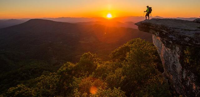
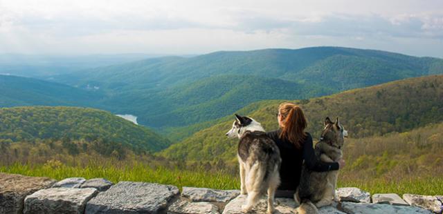
The Mount Rogers National Recreation Area is a 200,000-acre mountain parcel situated in Southwest Virginia, roughly between Damascus and Galax. Mount Rogers NRA contains Virginia’s loftiest terrain, namely 5,729 foot Mount Rogers, the highest point in Virginia and part of the nationally renowned Mount Rogers High Country, a melding of rare spruce-fir forest, open meadows, wild ponies and rock prominences. Mount Rogers NRA is also home to trout-filled streams, forested ridges, wild bears, numerous campgrounds, room to roam and around 500 miles of trails to explore.
Elevation ranges at Mount Rogers NRA run from the aforementioned Mount Rogers down to around 2,000 feet at the New River to the east and Whitetop Laurel Creek in the west. This vertical variation helps create a biodiversity unmatched in Virginia’s Appalachians. A wide array of outdoor activities allows visitors to enjoy this rich biodiversity. Mount Rogers NRA visitors can hike, bike, paddle, horseback ride, camp, fish, swim,auto tour, picnic and backpack. It truly lives up to its name as national recreation area.
Know Before You Go
Mount Rogers NRA lies within the greater Jefferson National Forest. The recreation area is stretched over a wide rural swath laced with mountain roads, both paved and gravel -- the going is slow. Supplies can be had in Damascus, as well as outlying towns of Abingdon, Marion, Wytheville and Galax. Stock up before you enter the recreation area.
The recreation area is very spread out. Don’t expect to see it all in a day. With numerous campgrounds and additional rental cabins here, it is easy to extend your stay, especially figuring in more lodging outside the recreation area.
Hiking Trails
Walkers, hikers and backpackers know Mount Rogers NRA as the hiking Nirvana of Virginia with its numerous long trails, rail trails and multi-use trails -- hikers can enjoy them all. Trail accesses can be had along creeks, atop mountains and all places in between, allowing you to construct added hikes of your own. For starters, here are a few hike suggestions to get you started exploring Mount Rogers NRA.
Short Sampler Hikes
Beartree Lake Loop – 1.0 mile
Start at Beartree Lake Recreation Area then encircle the mountain impoundment of Beartree Lake. Anglers use the loop to access their favorite fishing spots. This family hike stays around 3,000 feet in elevation.
Crest Trail/Appalachian Trail – 2.5 miles
The wide, road-like Crest Trail offers nearly continuous vistas as it courses the top of Pine Mountain from Scales. Wild ponies, which live in the recreation area year-round, are often seen in this stretch of the high country. Meet the AT after .8 mile, then return to the trailhead at Scales, winding in and out of woods.
Comers Creek Falls – 1.2 miles
This path traces Comers Creek — dropping steeply in small cascades and falls — into a rhododendron-choked gorge, then intersects the Appalachian Trail at .4 mile. To access the actual Comers Creek Falls turn right on the AT and continue another .2 mile to view the cataract dropping about 15 feet in a stair step fashion.
Loop Trails
Feathercamp Loop - 6.7 miles
Trails Used: Beech Grove Trail, Iron Mountain Trail, Feathercamp Trail, Appalachian Trail
This loop leaves the Whitetop Laurel Valley on the Beech Grove Trail up to the crest of Iron Mountain. Next, cruise the ridgeline to Feathercamp Branch and descends the intimate stream valley to intersect the Appalachian Trail. Take the AT back to the Beech Grove Trail and return to the parking area. Along the way, enjoy streamside woods and open pine oak stands atop Feathercamp Ridge. The climbs are never overly steep or long.
Rowland Falls Loop - 11.8 miles
Trails Used: Rowland Creek Trail, Old 84 Trail, Jerrys Creek Trail
Climb up the attractive Rowland Creek Valley to even more attractive Rowland Falls. Crest out at the Old 84 Trail and make a high country traverse in the shadow of Double Top and Round Knob to Jerry Creek, where the path takes you down quickly, then moderates, before completing the loop. The climb up Rowland Creek valley is steady, but never too steep.
Wilburn Ridge Loop - 5.2 miles
Trails Used: Rhododendron Trail, Rhododendron Gap Trail, Crest Trail, Appalachian Trail, Wilburn Ridge Trail, Appalachian Trail
Leave Grayson Highlands State Park at Massie Gap and ascend on the Rhododendron Trail. Enter Mount Rogers NRA and take the Rhododendron Gap Trail for great views to the Crest Trail. Turn right on the Crest Trail and follow it a short distance to Rhododendron Gap. Pick up the Appalachian Trail and follow it along Wilburn Ridge to the Wilburn Ridge Trail. Do a little rock scrambling in between vistas, then return to the state park via the Appalachian Trail.
Biking
The mountainous terrain caters to mountain bikers at Mount Rogers NRA. A wealth of trails is open to them. However, casual pedalers can enjoy bicycling on the two primary rail trails here, as well as more level, paved campground roads and a few other select locations. Here are some recommended loop pedals for mountain bikers followed by trips for casual bicyclists.
Bike Loops
Sandy Flats Loop – 7.9 miles
Trails Used: Forest Road 90, Bushwacker Trail, Iron Mountain Trail, Feathercamp Ridge Trail, Sawmill Trail, Rush Trail, Iron Mountain Trail, Forest Road 90
This loop leaves Forest Road 90, climbs to the Bushwacker Trail on to Sandy Flats. From here take the Iron Mountain Trail west to the Feathercamp Ridge Trail and make a steep decline to the Sawmill Trail. Once on the Sawmill Trail, gain a few views before dropping down to Rush Creek. Climb away from Rush Creek on the Rush Trail to reach Forest Road 90. Then take this gravel road down to the point of origin. The numerous trail intersections will inspire you to make some loops of your own.
Grosses Mountain Loop – 10.7 miles
Trails Used: Straight Branch Trail, Forest Road 837, Shaw Gap Trail, Iron Mountain Trail, VA 600
This loop ascends the Straight Branch Trail to make an extended descent past Beartree Campground and down Forest Road 837 to the Shaw Gap Trail. Climb up to the crest of Grosses Mountain and pick up the Iron Mountain Trail to pedal some great singletrack before passing the Straight Branch trail shelter. Emerge onto VA 600 and make a lightning descent back to the Straight Branch Trail. There are no real long climbs.
Rhododendron Gap Loop – 8.1 miles
Trails Used: Crest Trail, Rhododendron Gap Trail, Virginia Highlands Horse Trail
Head away from Scales on the Crest Trail and immediately gain views of the high country. Climb to Rhododendron Gap, passing numerous other paths. Descend a bit past Rhododendron Gap and intersect the Rhododendron Gap Trail. Turn left on the Rhododendron Gap Trail and head through some rocky sections through which you may have to walk your bike. The pedaling eases upon intersecting the wider Virginia Highlands Horse Trail. Take the VHHT down into Big Wilson Creek and more views before climbing back to Scales.
Rail Trail Biking
Bicycling rail trails at Mount Rogers is very popular, since two of Virginia’s finest rail trails run at least partly through the recreation area. Damascus and Galax have outfitters galore in case you need to rent a bike. Here are some recommended rides.
Whitetop Station to Damascus – 17 miles
Get a shuttle to the top then enjoy this almost all downhill run on the Virginia Creeper Trail. The ride starts high and descends to Whitetop Laurel Creek, crossing numerous trestles along the way. Doable by almost anyone who can ride a bike, even kids.
Galax to New River and Back – 24 miles
This is a scenic section of the New River Trail that follows the old railroad bed of the Norfolk and Western Railroad. It starts out along intimate Chestnut Creek, passing through attractive woodlands, pasturelands and Chestnut Creek Falls. It then crosses the thousand-foot Fries Junction trestle and enters the much large New River Valley. Bike rentals are available in Galax.
Damascus to South Holston Lake and Back – 16 miles
This section has a pastoral feel than the upper section of the Virginia Creeper Trail. From Damascus, the Creeper passes by many homes, where there are gates to cross. And there is plenty of scenery to enjoy, as the trail descends alongside Laurel Creek and the South Fork Holston River. A highlight of the trip is the long and high trestle that spans the confluence of the South and Middle forks of the Holston River.
Horseback Riding
Equestrians at Mount Rogers have their own dedicated 80-mile path — the Virginia Highlands Horse Trail — in addition to many other trails to trace. They also have their share of additional paths to enjoy from one end of Mount Rogers NRA to the other. Two campgrounds created for equestrians serve as base camps. Here are a few sample rides to get you enthused.
Taylors Valley Loop – 12.5 miles
Trails Used: Virginia Creeper Trail, Taylors Valley Trail
This circuit follows the Virginia Creeper Trail up along Whitetop Laurel Creek, with is many rapids, crossing numerous trestles to reach Creek Junction. Here, riders ford Whitetop Laurel Creek and pick up the Taylors Valley Trail. This path climbs past a homesite and drops down into Taylors Valley. Backtrack a bit on the Creeper Trail to complete the loop.
Fox Creek Loop – 7.8 miles
Trails Used: Virginia Highlands Horse Trail, Iron Mountain Trail, Flat Top Trail, Fairwood Valley Trail
This loop starts and ends at Fox Creek Horse Camp, making it especially convenient for equestrians. Take the Virginia Highlands Horse Trail up Locust Ridge to meet Iron Mountain. Here, the horse trail and Iron Mountain Trail share treadway to reach Flat Top. Descend on the Flat Top Trail to Fairwood Valley and the Fairwood Valley Trail. Cruise down the Fairwood Valley back to Fox Creek Horse Camp.
Horse Haven Loop – 8.5 miles
Trails Used: East Fork Trail, Virginia Highlands Horse Trail, Forest Road 14, East Fork Trail
Leave attractive Hussy Mountain Horse Camp and head east on the East Fork Trail to meet the Virginia Highlands Horse Trail. Climb up to Horse Heaven on the VHHT and enjoy occasional views before dropping back down to East Fork. Take Forest Road 14 just a short distance to pick up the East Fork Trail, which winds beneath large pines of the valley to return to Hussy Mountain Horse Camp.
Fishing
Fishing is very popular in the recreation area. With streams aplenty and even a few small lakes, Mount Rogers NRA has ample places to wet a line. Here are a few sample fishing destinations:
Beartree Lake
Beartree Lake, 11 acres, is part of the larger Beartree Recreation Area. It is popular and enjoyed by all types of recreationalists. Beartree Lake is a put and take fishing proposition. The primary catch is rainbow trout. The big ones are down deep, and as the summer wears on, the smaller ones join them.
Whitetop Laurel Creek
Whitetop Laurel is the primary fishing stream of the recreation area’s west end. It is a special regulations waterway with both brown and rainbow trout plying its shoals and holes. Brook trout are rumored to be in its headwaters and feeder streams. There is a 12-inch minimum size limit using artificial lures only, with a number limit of 6 per day. There are several handicap accessible fishing piers along the stream near Creek Junction.
Lewis Fork
Flowing off the slopes of Mount Rogers in the Lewis Fork Wilderness, this nifty little trout stream offers scenic angling. Brook trout inhabit the steep pool/fall environment. Anglers here will be seeking an attractive fishing environment that ranges between 3,600 and 4,500 feet, as well as getting a few fish on the line. Fishing pressure decreases away from VA 603.


